Browse

The Browse tool initializes the Data Browser which is used to review properties of selected features. The Data Browser dialog provides a navigator type graphical user interface which conveniently collects XFM feature properties from a view, fence or selection set. Individual or groups of feature instances can be selected for locating or HTML report generation.

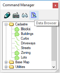
The Browse tool can also be found in the Command Manager.
The above key-ins:
- Can be followed by an arbitrary number of FEATURE=FEATURE.NAME or CLASS=FEATURE.NAME. Both FEATURE and CLASS have the same effect and can't be used together in the same command.
- Support an arbitrary number of AUTOLOCATE=VIEW.NUMBER which sets the automatic location option to the specified views.
- Allow the option ZOOMFACTOR=# which is a positive decimal value that sets the zoom factor.
These additional options do not need to be in a specific order.
Examples:
MAP QUERY BROWSE VIEW=1 FEATURE=BUILDING FEATURE=ROAD FEATURE=FOREST AUTOLOCATE=2 ZOOMFACTOR=1.5 loads all elements visible in View 1 whose feature name is either "building", "road" or "forest" into a new Data Browser window. Additionally, the automatic locate in View 2 is set for all loaded elements and the zoom factor is set to 1.5.
MAP QUERY BROWSE FENCE CLASS=BUILDING AUTOLOCATE=1 AUTOLOCATE=2 loads all elements in the fence whose feature name is "building" into a new data browser window. The automatic locate is set for all elements for the views and 2.
For details on using the Data Browser, please refer to Data Browser and Search Tools.